AI Can Cross Disciplines. It Still Can’t Replace Expert Judgment
By Philip O. ObazeeAI Can Cross Disciplines. It Still Can’t Replace Expert Judgmentfirst published on Substack on April 28, 2026Large language models (LLMs) have becom...

Katsina State was created out of the former Kaduna State on Wednesday, September 23, 1987, by the Federal Military Administration of General Badamasi Babangida. That event added another dimension in the annals of social and political transformation of the area. The State has a population of 5.79 million people according to the 2006 provisional census figures. The main occupations of the people are farming, traditional handicrafts and animal husbandry. Maize, millet, guinea corn, cassava, irish potato, yams and beans are the major food crops, while cotton, tobacco, sugarcane, soya beans and groundnuts are the major cash crops. The State is also one of the major producers of tomatoes, pepper and onion in the Country.
Visit site
Kebbi State is located on the north western part of Nigeria between latitudes 10¬0 and 130N and longitudes 3030’ and 60E. It has a total landmass of about 37,699 square kilometers out of which 36.46% is made up of farmland. However, about one third of the state is situated in desert prone environment thus making it one of the front-line states for the menace of drought and desertification. The state shares an extensive border with Niger Republic to the North and Benin Republic to the west with many inter-cultural and ethnic linkages. It is internally bordered to the North-East by Sokoto State to the East by Zafara State and to the south by Niger State.
After Nigeria’s independence in 1960 and following the state creation, the area was first, part of the North-western state (1967-1976), Sokoto state (1976-1991) and with Birnin Kebbi as the State, created on 27th August 1991 with Birnin Kebbi as the state capital. It currently has twenty-one local Government Areas.
Visit site
Kogi State was carved out of the old Kwara and Benue States. The birth of the new State was a reunion of a people who had shared a common history and had co-existed as one polity for a period of over seven decades before being severed by the 1976 States creation exercise. No doubt, Kogi State is abundantly blessed in both human and natural resources.
The creation of the State on the 27th August 1991 by the administration of former President Ibrahim Babangida was a dream fulfilled and one which seeks to put the State on the threshold of rapid socio-economic transformation.
Visit site
Kwara State is a state in the Middle Belt region of Nigeria, bordered to the east by Kogi State, to the north by Niger State, and to the south by Ekiti, Osun, and Oyo states while its western border makes up part of the international border with Benin Republic. Named for the Hausa word "Kwara" for the River Niger—which makes up much of the state's northern border—Kwara State was formed from the Northern Region on 27 May 1967 as the West Central State. Its capital is the city of Ilorin and the state has 16 local government areas.
Visit site
Lagos State is a state in southwestern Nigeria. Of the 36 states, it is both the most populous and smallest in area. Bounded to the south by the Bight of Benin and to the west by the international border with Benin Republic, Lagos State borders Ogun State to the east and north making it the only Nigerian state to border only one other state. Named for the city of Lagos—the most populous city in Africa—the state was formed from the Western Region and the former Federal Capital Territory on 27 May 1967.
Visit site
Nasarawa State is a state in the Middle Belt region of Nigeria, bordered to the east by the states of Taraba and Plateau, to the north by Kaduna State, to the south by the states of Kogi and Benue, and to the west by the Federal Capital Territory. Named for the historic Nasarawa Emirate, the state was formed from the west of Plateau State on 1 October 1996. The state has thirteen local government areas and its capital is Lafia, located in the east of the state, while a key economic centre of the state is the Karu Urban Area—suburbs of Abuja—along the western border with the FCT.
Visit site
Niger State, one of the 36 states of Nigeria was created out of the defunct North Western state on 3rd February, 1976. Situated in the North central geo-political zone, Niger State shares its borders with republic of Benin (West), Zamfara State (North), Kebbi (North-West), Kogi (South), Kwara (South West), Kaduna (North-East) and the FCT (South-East).
Visit site
Ogun State is a state in southwestern Nigeria. Created in February 3, 1976 from the former Western State. Ogun State borders Lagos State to the south, Oyo State and Osun State to the north, Ondo State, and the Republic of Benin to the west. Abeokuta is both Ogun State's capital and most populous city; other important cities in the state include Ijebu Ode, the former royal capital of the Ijebu Kingdom, and Sagamu, Nigeria's leading kola nut grower.
Visit site
Osun State, occasionally known as the State of Osun by the state government, is a state in southwestern Nigeria; bounded to the east by Ekiti and Ondo states, to the north by Kwara State, to the south by Ogun State and to the west by Oyo State. Named for the River Osun—a vital river which flows through the state—the state was formed from the southeast of Oyo State on 27 August 1991 and has its capital as the city of Osogbo.
Visit site
Located in the South-West geopolitical zone of Nigeria, Oyo State was one of the three States carved out of the former Western State of Nigeria in 1976. Oyo State consists of 33 Local Governments and 29 Local Council Development Areas. Local Government Areas are: Afijio, Akinyele, Atiba, Atisbo, Egbeda, Ibadan North, Ibadan North-East, Ibadan North-West, Ibadan South-East, Ibadan South West, Ibarapa Central, Ibarapa East, Ibarapa North, Ido, Irepo, Iseyin, Itesiwaju, Iwajowa, Kajola, Lagelu, Ogbomoso North, Ogbomoso South, Ogo-Oluwa, Olorunsogo,Oluyole, Ona-Ara, Oorelope, Oriire, Oyo East, Oyo West, Saki East, Saki West and Surulere.
Visit site
AI Can Cross Disciplines. It Still Can’t Replace Expert Judgmentfirst published on Substack on April 28, 2026Large language models (LLMs) have becom...
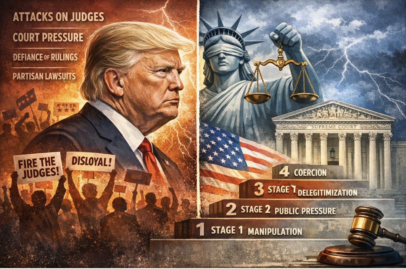
Intimidating The Judiciary: Trump and A Global History of Executive Pressure on Supreme Courts- From Washington to Berlin to Budapest, and the warning...
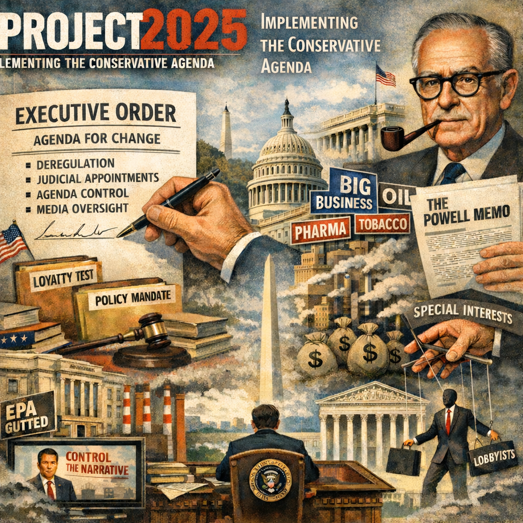
From the Powell Memo to Project 2025: How a 1971 Corporate Strategy Became a Global Template for PowerIn August 1971, a corporate lawyer named Lewis P...
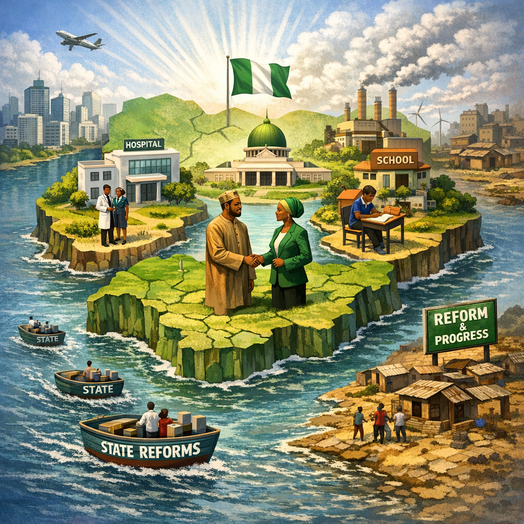
Islands of Credibility: Nigeria’s Best Reform Strategy Starts in the StatesFirst published in VANGUARD on January 31, 2026 https://www.vanguard...
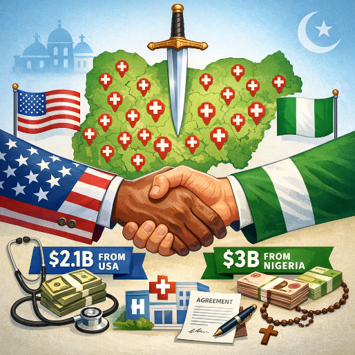
Project 2025 Agenda and Healthcare in NigeriaThe US and Nigeria signed a five-year $5.1B Memorandum of Understanding (MoU) on December 19, 2025, to bo...

General / Apr 05, 2005
A Call for an Overhaul of Government StructureSocial & Political Issues / Aug 14, 2006
A Birthday Reflection At 65Social & Political Issues / Mar 08, 2006
A better Approach To Governor Ibori’s Developmental Efforts In WarriSocial & Political Issues / Nov 12, 2006
A Ballot On The Right Hand, Cudgel On The Left© 2026 Segun Toyin Dawodu | All rights reserved